Mørupstenen
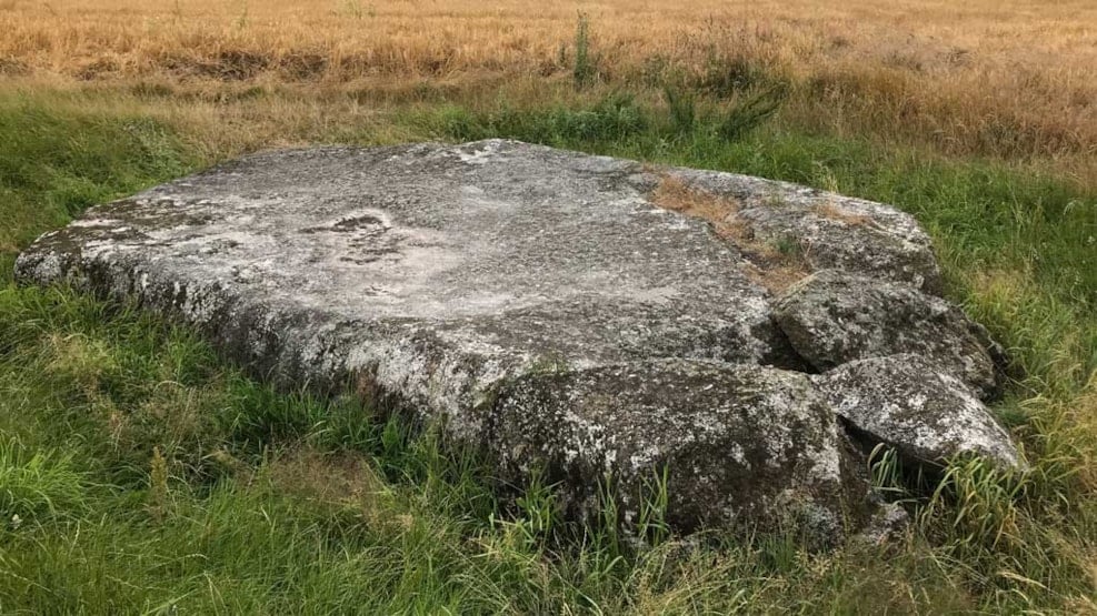
In the rolling landscape west of Herning lies the Mørup Stone – an impressive relic from the Ice Age and one of Denmark’s largest boulders. For more than 115,000 years, it has rested quietly in the soil, half hidden beneath the surface, as a silent witness to the immense forces that once shaped our landscape. Today, it stands as both a natural landmark and a reminder of our country’s deep geological history.
A remarkable giant
For more than 115,000–120,000 years, the Mørup Stone has rested in a field near Snejbjerg. The stone is a glacial erratic made of larvikite – a type of rock originating from the Larvik area in Norway – and was carried here by the ice during the penultimate Ice Age.
Today, only the top of the stone is visible – it measures about 9 metres in length, 4 metres in width, and rises approximately 0.5 metres above the ground. But most of it is hidden beneath the surface: according to GEUS’ geophysical surveys, the stone has a total height of around 6 metres, meaning that over 5 metres lie buried underground.
With an estimated volume of about 185 m³ and a weight of roughly 500 tonnes, the Mørup Stone is Denmark’s second-largest boulder, surpassed only by the Hesselager Stone on the island of Funen.
The stone was first mentioned in Herning Folkeblad in 1884, which wrote:
“In Mørup in Rind, an unusually large stone has been found. It measures 16 ells in length, 14 ells in width, and 2 ells in depth. Since then, it has not gone back underground.”
A stone with a long journey
The Mørup Stone is a so-called indicator boulder of larvikite, a rock type that originates southwest of the Oslo Fjord in Norway. During the last Ice Age, glaciers transported the boulder across vast distances before depositing it in Mid Jutland. Larvikite is easily recognised by its bluish-grey crystals that sparkle in sunlight.
Geological analyses show that the Mørup Stone has been exposed for approximately 75,000 years – ever since the ice melted away. It is therefore a valuable clue to understanding how ice once moved across Denmark.
A living piece of natural history
The surface of the boulder hosts a rich flora of mosses and lichens – more than 15 species have been recorded, including rare species such as Umbilicaria deusta. To protect this flora, the vegetation around the stone is kept low, allowing sunlight to reach its surface.
The stone was officially protected in 1932 as a national natural monument.
Worth a visit
Today, the Mørup Stone is a protected site. An information board explains its geological background, and the location can be reached by bicycle or on foot from Herning. The route is about 15 km long and passes through the scenic landscape around Snejbjerg.
Find your way to the Mørup Stone
The Mørup Stone is located on Bliddalvej, west of Herning.
A small sign by the roadside points the way to the stone.
You can park along the roadside or on the small turning area.
From there, follow the long gravel and farm track on foot.
After about 500 metres, the stone can be seen in the field on your left.
There are no buildings or fences around it, and visitors are free to walk right up to the stone.
GPS coordinates: 56.115688060352674, 8.916140394357532
Facts at a glance:
Location: West of Herning, near Snejbjerg
Rock type: Larvikite (from Norway)
Length: approx. 8.6 m
Width: approx. 4.4 m
Depth: approx. 3.5 m
Weight: approx. 500 tonnes
Protected: 1932
Status: Denmark’s second-largest boulder